
Over the years, rural residents across the SSP network have shared with me what they want from Tongass management: more subsistence and local recreation, a reliable timber supply for local uses, healthy salmon waters, support for Tribal stewardship, and direct collaboration on annual priorities.
The Community Alternative is a draft Forest Plan option built to deliver just that: more subsistence resources, salmon protection Tongass-wide, smart investments to kick-start young-growth timber, recreation, and tourism, and community partnership baked into annual priorities. Take a look and tell us: Does it reflect your values, and would it work on the ground?
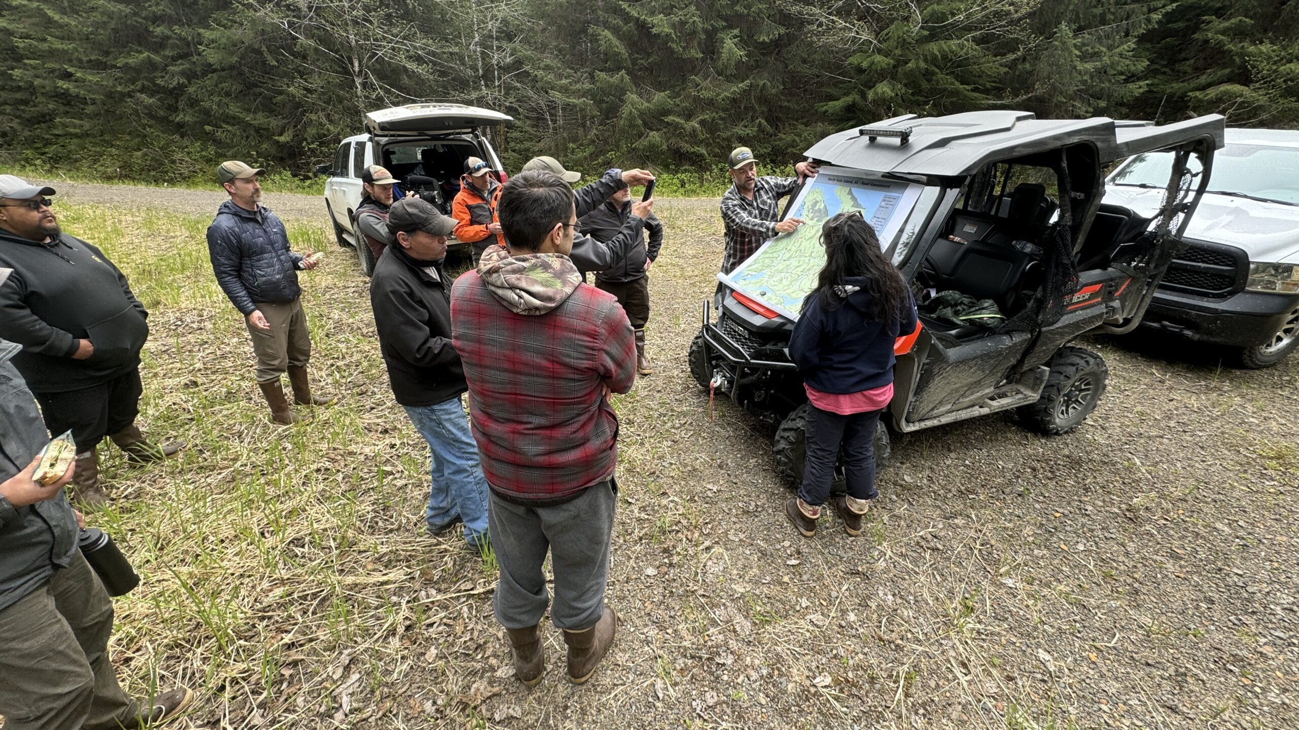
Hi, I’m Bob Christensen, the SSP’s Regional Catalyst for Community Forestry. My host organization is The Nature Conservancy. This page shares a community-centered example alternative for the Tongass Forest Plan Revision that is based on nearly 20 years working with community and regional partners.
Use the buttons below to review the Need to Change Assessment, Community Alternative Overview, Management Area Map and the Conservation Narrative; then use the Feedback Form to share what you support, what you don’t, and what you’d add. If you want to dig deeper, explore the Plan Components, NEPA Science or the additional Tongass Tools included at the bottom of the page: Stewardship Decision Tool, the Young-Growth Road Map, and the Tongass Blueprint materials.
Keep in mind that this community alternative is just one example of how we can manage the forest differently than has been done in the past. Efforts by the Alaska Forest Association, The Central Council of the Tlingit and Haida Indian Tribes of Alaska, The Juneau Economic Development Council and the Tongass Recreation Partnership are a few additional approaches that I am aware of. Please check these efforts out as well.
For the official Forest Plan Revision background and process, start here.
🗓️
What’s Happening Now
The US Forest Service (USFS) has released preliminary draft plan components and is seeking comments on this content until May 6. We prepared an assessment and a comment helper, so your input is clear, specific, and usable.
🧭
Community Alternative Overview
A quick read on what the Community Alternative proposes and why. Covers subsistence, salmon, young-growth timber, recreation and tourism, Tribal stewardship, and community collaboration.
🗺️
Management Area Map
The community alternative uses three area types: Community Priority is road-accessible from communities; Remote with Roads is roaded but not community-accessible; Remote without Roads has no open roads.
📏
Plan Components & Standards
The enforceable guardrails that make the community alternative accountable: watershed conservation lands, roads, timber, subsistence, recreation, and clear collaboration, implementation and monitoring triggers.
More Tongass Products
📊
Stewardship Decision Tool
Compare conservation priorities and timber pathways side by side, watershed by watershed. The tool makes tradeoffs visible so communities can discuss options using the same map, assumptions, and “what changes what” logic.
🛣️
Young Growth Road Map
A practical pathway for scaling young-growth management and local wood products. Read the Road Map, check out the key numbers document and then provide feedback on where the Road Map is on/off track.
📘
Tongass Blueprint 2.0
“Tongass Blueprint 2.0 is a Roadmap Series (see the YG Roadmap above) turning Blueprint 1.0’s vision into partner-owned actions. Start with 1.0, skim the 2.0 prospectus, then share input.”
🦌 Subsistence
The Community Alternative treats subsistence as a core management purpose in the watersheds closest to communities, not just a project-by-project consideration. Consistent with ANILCA Title VIII, it manages Community Priority areas to maintain and improve access to deer, salmon, berries, firewood, red cedar, and other key foods and cultural materials near the communities that rely on them most. It ties project design and permit decisions to measurable indicators such as deer habitat productivity, salmon habitat condition, berry productivity, access conditions, and road risk, so progress can be checked through rolling plans and five-year reviews rather than treated as a paperwork exercise.
Frequently Asked Questions
Q: What is a “Subsistence Access & Opportunity profile”?
A: It is a place-based summary of how subsistence opportunity is created or constrained for a community (access routes, timing, key areas, conflict points), used to guide design measures and monitoring for projects and permits.
Q: How does the Community Alternative move beyond procedural compliance?
A: It requires early indicator checks, measurable design measures, and scheduled reviews tied to outcomes (for example, deer habitat productivity, salmon habitat condition, and berry productivity) rather than relying only on case-by-case NEPA discussion.
Q: How does ANILCA fit into the Community Alternative?
A: ANILCA Title VIII is the legal foundation for federal subsistence management on the Tongass. The Forest’s own preliminary draft says the subsistence section tiers to ANILCA and that ANILCA should be consulted for all projects. It also explains that Section 804 gives a subsistence priority for fish and wildlife on federal public lands, and that Section 810 requires federal managers to analyze actions that may significantly restrict subsistence uses, provide notice and a hearing, and take reasonable steps to minimize adverse impacts while evaluating alternatives. The Community Alternative builds on that legal foundation by adding clearer local indicators, early screening, and rolling reviews in community-accessible watersheds.
Q: How does this affect timber proposals near communities?
A: It does not make all timber proposals near communities off limits, but it does require them to be designed so they do not quietly chip away at subsistence opportunity. In community-accessible watersheds, the Community Alternative screens proposals early against deer, salmon, berries, access, and culture-wood indicators and requires place-based design measures where risks show up. If a federal action may significantly restrict subsistence uses, ANILCA Section 810 still applies, including analysis, public notice, a local hearing, and reasonable steps to minimize adverse impacts and consider alternatives. That gives the Forest a stronger, more transparent basis for limiting or reshaping high-conflict proposals where subsistence opportunity would otherwise be reduced.
Q: How does it address berries and other gathered foods?
A: It identifies priority berry areas near communities and access corridors and maintains conditions that support production (for example, maintaining open canopy or early-seral patches where appropriate and limiting impacts from competing uses).
Q: How are conflicts from roads and visitor use handled?
A: It uses permit tools, access management, and rolling five-year plans led with community and Tribal input to reduce resident displacement and manage conflict in high-use watersheds. The goal is to maintain or improve actual subsistence access, not just acknowledge it in project files.
🥾 Recreation
The Community Alternative invests in recreation close to communities by improving cabins, shelters, trailheads, small-boat and ORV access, day-use facilities, and staffing where use is already high. It protects resident access first, uses capacity tools and site playbooks at hotspots, and tracks site conditions, crowding, and access so recreation stays welcoming, safe, and compatible with fish, wildlife, and cultural values.
Frequently Asked Questions
Q: How are Recreation Emphasis Areas selected?
A: They are identified through Community Advisory Committees (CAC) rolling plans and site-level data, focusing on near-community hotspots where staffing, maintenance, and capacity tools can protect resident access and fish, wildlife, and cultural values.
Q: Will the Community Alternative restrict resident recreation through permits or fees?
A: The focus is on managing commercial use and hotspots; resident access is protected first. Any limits would be site-specific and used only where needed to prevent displacement or resource damage, paired with reinvestment in facilities, staffing, and maintenance.
Q: How does the Community Alternative protect resident access at popular sites?
A: It requires permit tools and site-specific management that protect local use (for example, local-use windows, resident-first parking/launch allocations where appropriate, and adaptive measures when crowding displaces residents).
Q: What are “capacity tools” and “site playbooks”?
A: They are enforceable, place-based visitor management actions tailored to a specific hotspot (for example, parking/launch management, use limits, timing windows, staffing/monitoring, education, and closures when needed) so use levels match site capacity.
🐋 Tourism
The Community Alternative gives tourism operators clearer expectations, better-managed destinations, and more dependable infrastructure and staffing where visitor use is appropriate. It prioritizes additional high-quality destination infrastructure and staffing in Remote without Roads where appropriate, while supporting near-community tourism sites in Community Priority Areas where local and Tribal partners support them and where resident access and other community priorities are protected.
Frequently Asked Questions
Q: Are there areas identified as most suitable for tourism development?
A: Yes. The Community Alternative prioritizes additional high-quality destination infrastructure and staffing in Remote without Roads where appropriate, and supports near-community tourism sites in Community Priority Areas where CACs and local or Tribal partners also support tourism development.
Q: How does the Community Alternative prevent tourism from displacing residents?
A: It requires permit tools that protect local access (for example, local-use windows and resident-first parking/launch allocations where appropriate) and adaptive site management at hotspots; where allowed, commercial fees are reinvested locally to fund staffing and maintenance.
Q: Does the Community Alternative allow tourism growth everywhere?
A: No. It focuses most destination-scale growth in Remote without Roads where appropriate and requires enforceable capacity tools at hotspots so visitor use does not degrade scenery, wildlife viewing, cultural places, or resident quality of life.
Q: Do commercial fees benefit the local area?
A: Where allowed, the Community Alternative emphasizes cost recovery and local reinvestment mechanisms to fund on-the-ground staffing, maintenance, and conflict reduction at shared-use sites.
🌀 Tribal Priorities
The Community Alternative treats Tribal priorities as part of how the forest is managed on the ground, not just as a consultation step. It supports tribally approved territory maps, Tribal representation in Community Priority planning, territory-based forums elsewhere, guardian and stewardship crews, dependable culture-wood pathways, cedar stewardship, and practical protection for sacred places, subsistence areas, access sites, and other traditional use areas. It also ties this work more clearly to ANILCA Title VIII by protecting and improving the deer, salmon, berries, cedar, firewood, access routes, and other living resources that support Tribal subsistence, cultural practice, and intergenerational use.
Frequently Asked Questions
Q: What changes beyond project-by-project consultation?
A: The Community Alternative institutionalizes co-stewardship through standing forums, shared positions where needed, Tribal representation on CACs in Community Priority Areas, territory-based forums elsewhere, and predictable treatment of culture wood, access, monitoring, and stewardship work that can survive staff turnover.
Q: How is Indigenous Knowledge used in plan implementation?
A: Indigenous Knowledge is integrated as Best Available Scientific Information (BASI) in project design, monitoring, and adaptive reviews, including co-led five-year reviews of outcomes in priority areas.
Q: How are sacred and culturally significant sites protected?
A: It strengthens early screening, uses tribally approved territory maps to route engagement responsibility, and supports Tribal monitors/guardian crews and stewardship measures that protect culture-wood pathways, subsistence camps, access sites, and other culturally significant places.
Q: What does this mean for local jobs and on-the-ground presence?
A: It supports Tribal stewardship/guardian crews (and community forest crews) to fill monitoring and restoration capacity gaps, including monitoring impacts to cultural sites and key subsistence resources.
Q: How does ANILCA fit into the Tribal approach?
A: ANILCA Title VIII remains the legal baseline for protecting subsistence uses on federal lands, and the Community Alternative keeps that baseline visible from the start rather than treating it as a late project check. It applies ANILCA with a stronger Tribal and place-based lens by identifying culturally important watersheds, camps, access routes, cedar areas, berry grounds, and fishing and hunting areas early, then using that information to shape project design, permit decisions, and monitoring. If a federal action may significantly restrict subsistence uses, ANILCA Section 810 still requires analysis, public notice, a hearing, and reasonable steps to minimize adverse impacts and evaluate alternatives.
Q: How does this affect timber or road proposals near Tribal communities?
A: It does not make all timber or access proposals near Tribal communities off limits, but it does require them to be screened early against likely effects on deer, salmon, berries, cedar, camps, travel routes, and other resources that support Tribal use and stewardship. That gives the Forest a clearer basis for reshaping, relocating, phasing, or limiting high-conflict proposals when they would reduce subsistence opportunity, cultural access, or the long-term function of the watersheds people rely on most.
🪵 Timber
The Community Alternative builds a reliable young-growth backbone for local forest products while keeping old growth in a tightly limited transition lane. During the transition, old growth is focused first on culture wood, tone wood, specialty local uses, restoration, and a declining bridge-timber volume in eligible Working Forest Lands that tapers after 2030 and reaches zero by 2032. Beyond the transition, small old-growth micro-sales for culture wood, tone wood, and other very high-value specialty products could continue at a nominal regional level of less than 5 million board feet per year. This approach is designed to keep timber more deliverable by screening out high-conflict acres early and tying supply to measurable watershed and operability sideboards.
Frequently Asked Questions
Q: What are Working Forest Lands (WFL)?
A: WFL are the remaining productive forest generally below about 800 feet, outside Watershed Conservation Lands, and excluding sensitive karst, sacred or cultural sites, and other high-conflict areas. Within that pool, the Community Alternative favors operable, lower-conflict places (for example, previously roaded young growth while avoiding stream-dense areas identified with LiDAR, endemic hotspots, wetland bottlenecks, and high-use cultural or recreation areas).
Q: What does “deliverable timber” mean in this alternative?
A: Supply projections are screened for access and operability and include conservative ‘fall-down’ factors calibrated to recent on-the-ground layout experience, so offered volume better matches what can actually be implemented. In short: inventory capability is not deliverability (operable, economically feasible, low-conflict, and implementable). The alternative also assumes volume should be screened early against riparian, karst, wetland, endemic-hotspot, and watershed-retention constraints so NEPA and sale prep are not built around acres likely to vanish later.
Q: When is old-growth harvest allowed?
A: Old-growth harvest is gated to Working Forest Lands only when watershed-scale retention standards are met and will remain met after the action. Bridge timber is temporary, declines after 2030, and ends by 2032. In Watershed Conservation Lands, old-growth activity is limited to selection harvest under the 15% basal-area cap and should focus on restoration, culture wood, and tone wood needs; after 2032, old-growth use is limited to culture wood, tone wood, restoration, and other specialty/local purposes. In Remote without Roads, no new roads are allowed for logging.
Q: How do rotations work under a young-growth backbone?
A: The Community Alternative identifies rapid-rotation forestry areas (~75-100 years) on the most suitable acres, and also allows longer rotations (for example, ~300 years) where growth rates are slower or higher-value wood objectives warrant. Young growth remains the long-term backbone; the temporary bridge-timber lane does not replace that trajectory. Forests above about 800 feet stay in the conservation backbone because those elevations are generally poor candidates for practical rotational forestry: historical logging there has been limited in practice, and regeneration is slow.
🌲 Conservation
The Community Alternative retains the core architecture and intent of the existing conservation strategy, but makes targeted modifications to implement it more clearly at the watershed scale. It uses a mapped watershed backbone of beach buffers, riparian buffers, forests above about 800 feet, Sensitive Karst Reserves, and Deer Winter Range Reserves where triggered, then ties that backbone to watershed-based standards and monitoring. The goal is to improve subsistence outcomes near rural and Tribal communities, strengthen climate resilience across streams, wetlands, fish habitat, deer habitat, and other ecological systems consistent with the 2012 Planning Rule, and make conservation results easier to track over time. It is also designed to improve timber planning by screening out likely high-conflict acres early, so NEPA and timber layout spend less time on places that routinely fall away under stream, deer, karst, and retention constraints.
Frequently Asked Questions
Q: Is this a completely new conservation strategy?
A: No. The Community Alternative keeps the basic conservation backbone of the existing strategy, but updates how it is applied. The biggest shift is to make conservation more watershed-based, more measurable, and more responsive to current needs around subsistence, climate resilience, and implementation. Rather than relying as heavily on broad mapped reserves alone, it uses clearer watershed thresholds, mapped Watershed Conservation Lands, T77 aquatic-connectivity standards, and rolling monitoring so managers and the public can better see whether the strategy is working.
Q: How does the conservation strategy help expedite timber planning?
A: By making the conservation backbone more explicit up front, the Community Alternative helps keep likely fall-down acres out of the timber queue earlier in NEPA and layout. Working Forest Lands are screened to avoid places that commonly become high-conflict or non-deliverable later, such as stream-dense areas, sensitive karst, wetland bottlenecks, endemic hotspots, and watersheds that cannot meet retention thresholds. That makes offered volume more realistic, reduces late-stage redesign, and improves the odds that planned timber output is actually implementable.
Q: Why use a watershed-based approach to standards and monitoring?
A: Because many of the outcomes people care about most, like salmon productivity, deer winter range, berry access, hydrologic function, and subsistence opportunity, are shaped by cumulative conditions across an entire watershed, not just by what happens inside one project unit. A watershed-based approach makes it easier to apply clear thresholds, track conditions over time, and adapt management before problems become harder to fix.
Q: What happens to old-growth reserves in the Community Alternative?
A: If a watershed is below the 40% low-elevation retention floor, old-growth harvest is suspended and managers add retention and recovery areas in Working Forest Lands (prioritizing deer winter range, connectivity, and, where needed, larger contiguous blocks). If the target still can’t reasonably be met in the near term, mapped 2016 old-growth reserves (OGRs) within the watershed are retained as an interim backstop until late-successional characteristics emerge in restoration areas; adjacent-watershed OGRs may be retained for landscape connectivity but do not count toward the focal watershed’s retention accounting. If no mapped OGRs are available, the watershed is elevated for high-priority restoration/protection actions (STD-OG5a).
🛣️ Roads
The Community Alternative keeps roads where they are important for access, safety, and local economic use, while reducing the long-term road footprint that drives landslides, fish-passage problems, and maintenance costs. It right-sizes the system by maintaining key mainlines, reducing spur-road density where feasible, restoring hydrology on closed roads, and guiding decisions through CACs in Community Priority Areas and a regional advisory process for Remote with Roads and Remote without Roads.
Frequently Asked Questions
Q: Are roads allowed under the Community Alternative?
A: Yes. The Community Alternative allows roads in all areas for non-timber purposes such as transportation, public safety, renewable energy, mariculture, and other community-supporting infrastructure where appropriate. For timber, roads are allowed in Community Priority and Remote with Roads areas, but not in Remote without Roads. In all cases, road work must meet strong standards for fish passage, stream and wetland connectivity, and slope stability. In T77 watersheds, the standards are even more precautionary to help maintain salmon and wetland habitat function.
Q: What does “right-size the road system” mean?
A: It prioritizes maintaining key mainlines while reducing spur-road density (for example, targeting ~50% reduction in primary spurs per watershed where feasible) and restoring hydrology on closed spurs to reduce chronic maintenance and risk.
Q: How are fish passage and watershed connectivity addressed?
A: It requires climate-ready crossings (designed for larger peak flows with safety factors), sets measurable indicators for road density and hydrologic connectivity, and in wetland-rich watersheds tracks whether roads, fills, berms, or ditch lines are disconnecting peatlands, fens, or other important wetlands so those features can be modified or removed.
Q: Who decides which roads to keep open or close?
A: Priorities are co-developed through CACs in Community Priority Areas and a regional advisory process for Remote with Roads and Remote without Roads. Those forums guide rolling five-year plans, monitoring priorities, and road/trail decisions, with five-year reviews publishing indicator results and the Forest response.
🗺️ Management Area Map
The Community Alternative uses a simple three-area map to make the plan easier to understand and easier to apply on the ground. It centers community needs while still balancing conservation, access, recreation, and development through a combination of map designations and forest-wide standards. The goal is clarity: people should be able to tell what each area is for, what kinds of activities it supports, and how results will be tracked over time. The aim is not just a cleaner map, but a more practical plan with fewer surprises and less conflict. See the map by clicking here. See the map by clicking here.
Frequently Asked Questions
Q: Can additional Community Priority Areas be designated beyond the initial map?
A: Yes. The Community Alternative allows additional Community Priority Areas by community or Tribal government request, including unincorporated communities and communities without road access to neighboring watersheds, through the appropriate planning mechanism and documented plan-implementation updates, including CAC rolling plans where applicable.
Q: What if a Community Priority Area overlaps Wilderness or LUD II?
A: The more restrictive designation and applicable law govern. Community Priority designation does not change statutory limits (e.g., no commercial timber harvest in Wilderness).
Q: Can a Community Advisory Committee lower protections in its area?
A: No. CACs can help shape priorities, sequencing, restoration needs, access decisions, and locally supported opportunities within their area, but they are still bound by the forest-wide standards and guidelines as a firm baseline. They can recommend stronger local protections or more cautious approaches where needed, but they cannot reduce the minimum protections established across the forest.
Q: Does the map change roadless protections?
A: No. Current law and any applicable roadless requirements still apply. The Community Alternative’s Remote without Roads direction (maintain roadless character and prohibit new roads for logging) applies regardless of national Roadless Rule status, with details evaluated through the plan EIS and project-level analysis.
Q: How are T77 watersheds treated in the Community Alternative?
A: T77 watersheds remain a forest-wide conservation overlay across all management areas. In T77 watersheds, road or access work must show no net increase in hydrologically harmful road footprint and prioritize fixing barriers, wetland-flow problems, and other legacy impacts that affect salmon habitat. Where T77 overlaps Community Priority or Remote with Roads, young growth harvest may still occur if all forest-wide standards are met. In Remote without Roads, no new roads are allowed for logging.

